

Fred Baechler, friend of Cape Breton Weather Mesonet captured some wonder shots of our island from NASA.
Folks
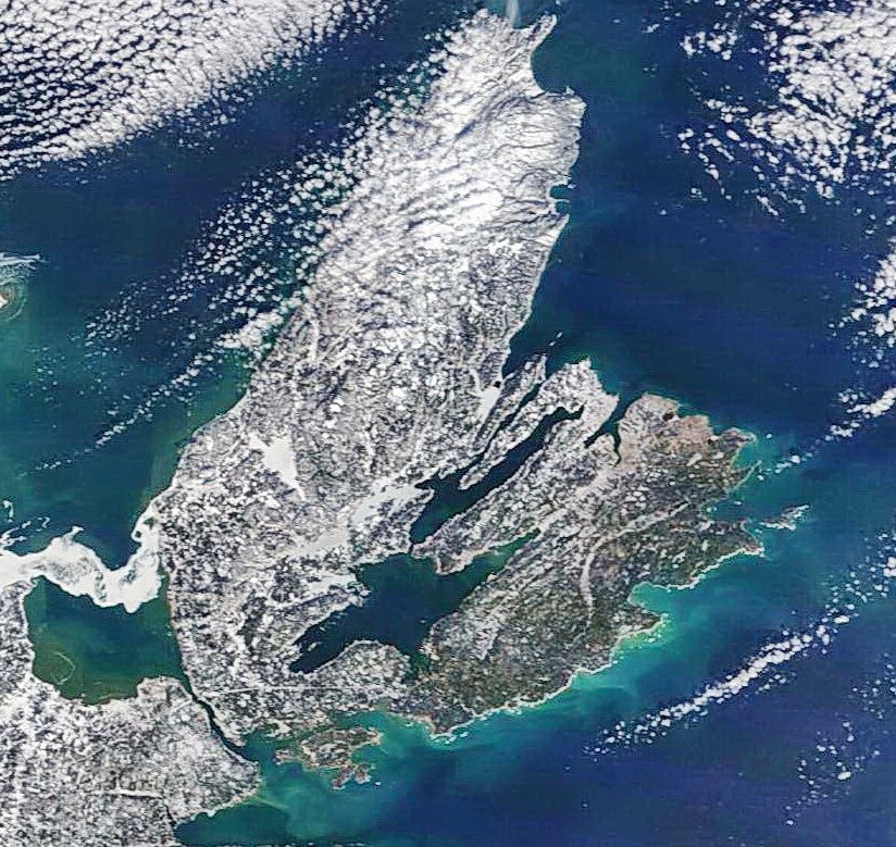
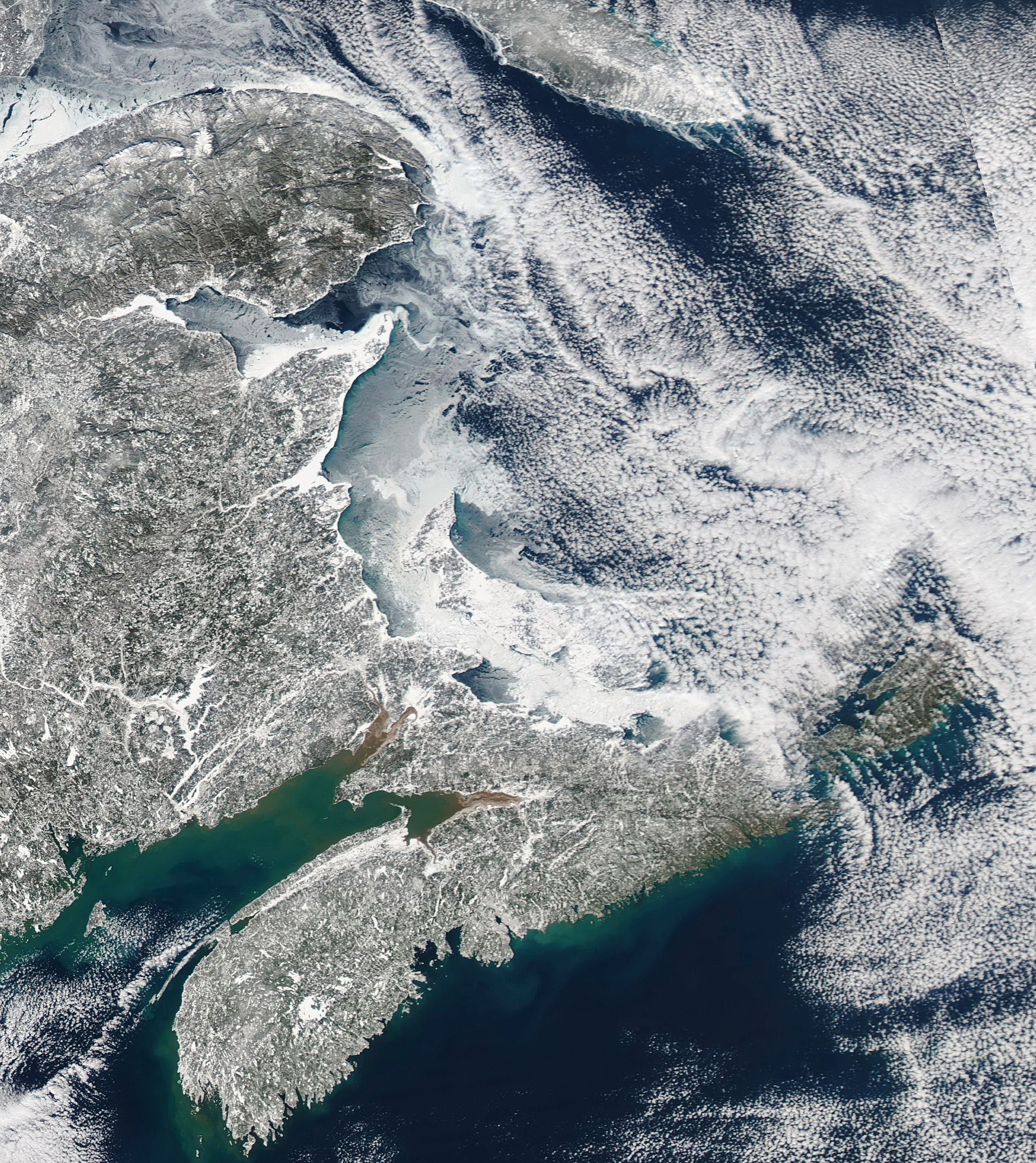
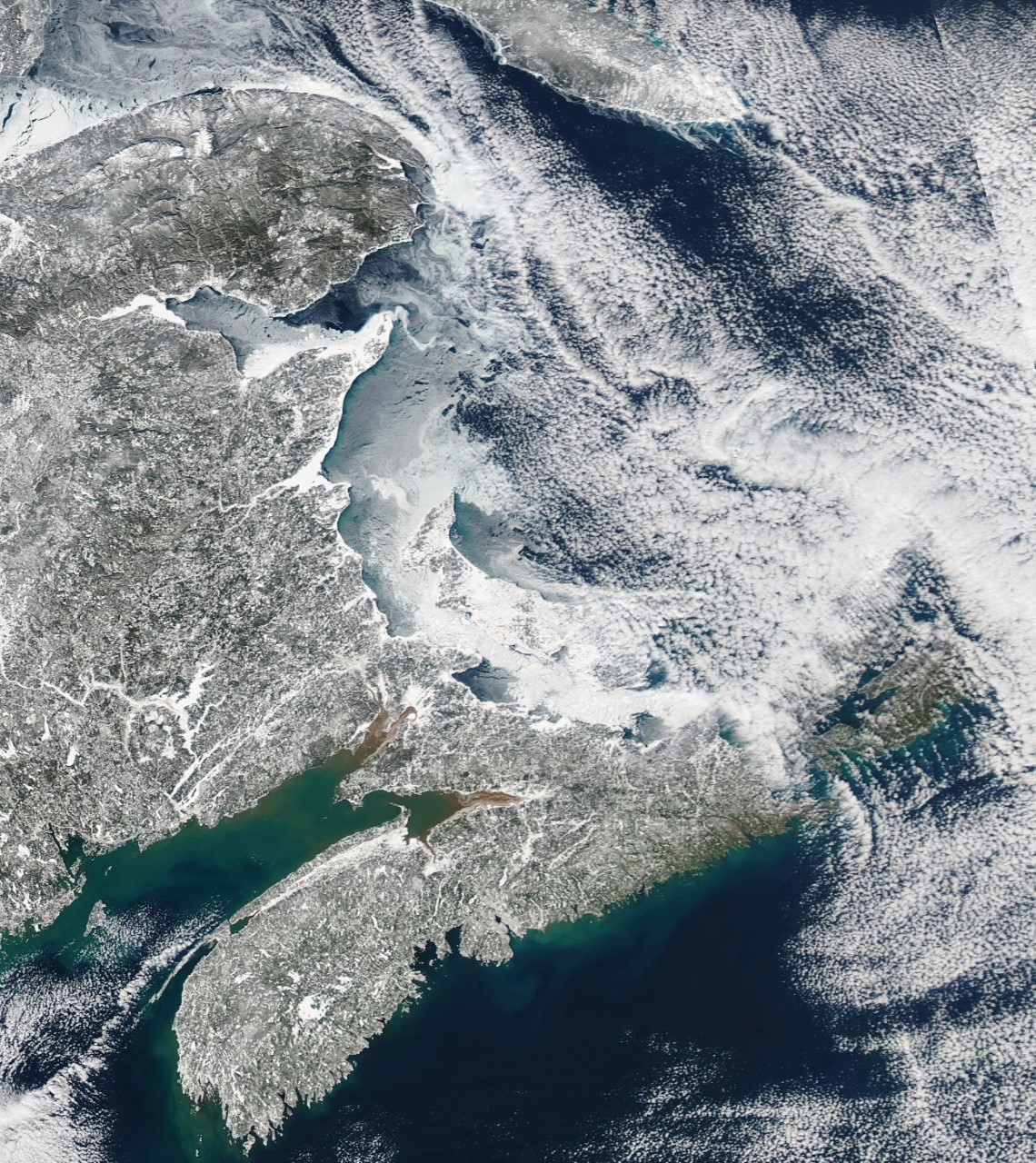
NASA’s Terra satellite captured a good shot of the Maritimes yesterday morning (attachment 1) after the big storm event. A close up shot of the Island is provided in attachment 2. Certainly shows the lack of snowpack around Sydney where we got the event mostly as rain. The storm surge created some sediment movement in the coastal regions along the southeast coast of the Island. Lakes are for most part all frozen over, even Lake Ainslie. Not much ice in the Bras d’Or Lake, except through St. Patrick’s channel. The only ice in the Gulf appears between PEI and NSc, with a thin trail hitting Port Hood. The 3rd attachment was taken this afternoon showing long cloud streets developed over the ice free Gulf and hitting the west coast of the Island….again missing the mainland.
Fred Baechler


0
Log In or Sign Up to add a comment.- 1
arrow-eseek-eNo items to display