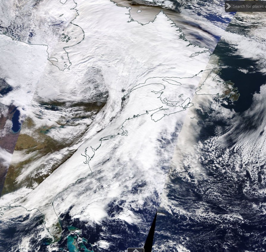
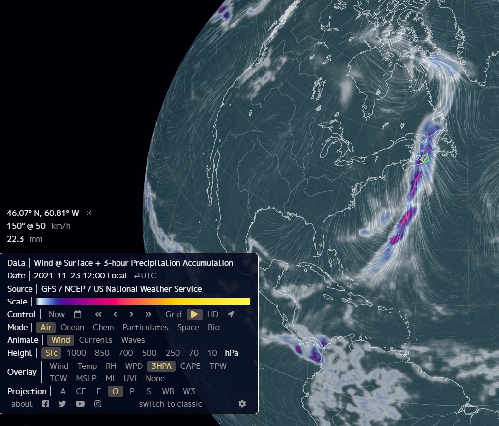
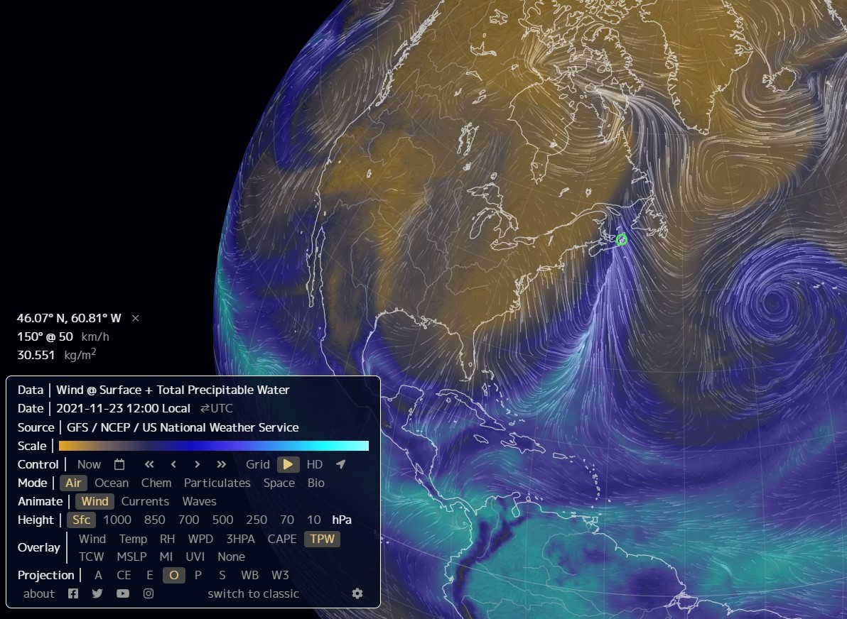
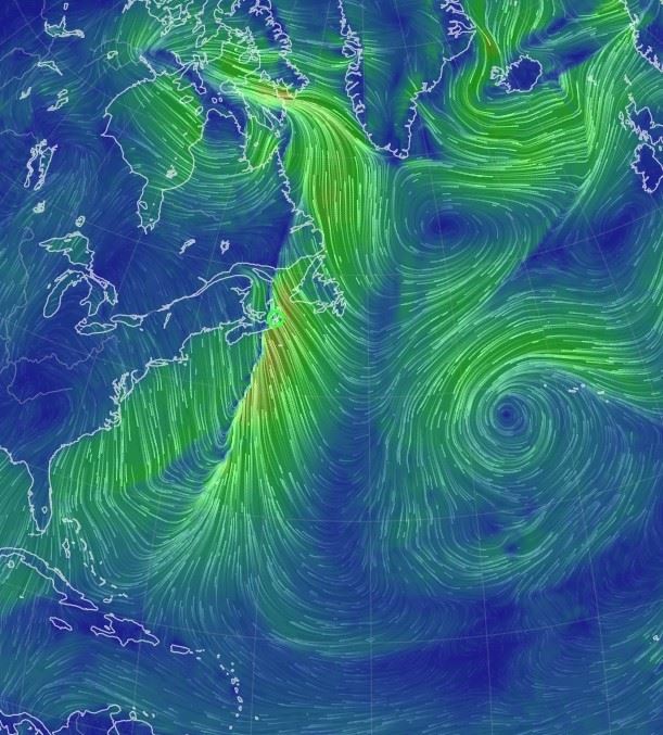
Wind/weather/ocean conditions showing the narrow line of winds directed up the “river” under the cloud cover
All images courtesy of NASA
As we have been hearing from Environment Canada and news weather reports, the recent rainfall event is termed an Atmospheric River, similar to the phenomenon causing the flooding problems in British Columbia.
Rainfall totals from Cape Breton Mesonet sites located on either side of the N-S line that runs up the middle of the "atmospheric river" demonstrate the difference in totals either side of the line. Over 150 mm of rain accumulation in Smelt Brook on the eastern side of the line vs. less than 50 mm in South Harbour and Cape North, less than a 15 minute drive away on the line's western side.
See more images below.

EOSDIS Worldview showing the cloud formation tracking up from the Caribbean

NASA image identifying the 3 hour precipitation accumulation within the “river.”

NASA image showing the amount of total precipitable water in the band of clouds within the “river.”


0
Log In or Sign Up to add a comment.- 1
arrow-eseek-eNo items to displayFacebook Comments