NASA Satellite Image Shows Footprint of Nova Scotia Wildfires

Photo Credit: NASA Aqua Satellite

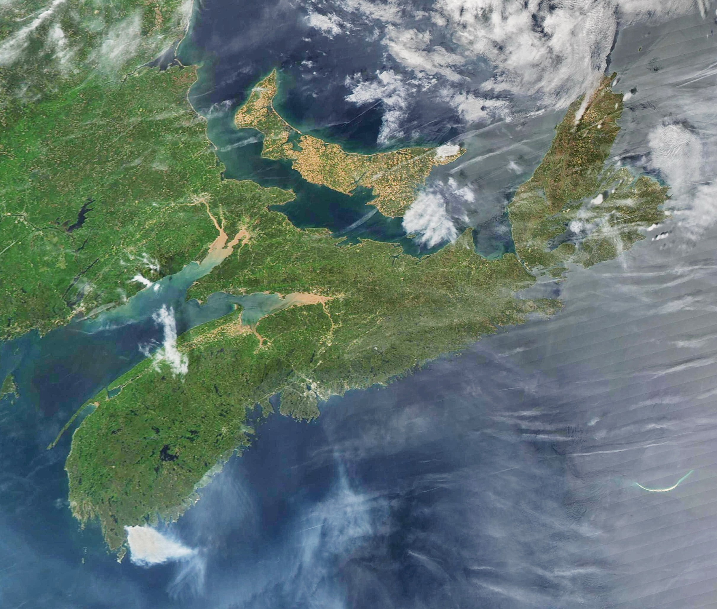
NASA’s Aqua satellite captured an image of the province the afternoon of May 30th showing the smoke plumes from the various fires on the mainland. 

Quite a number of jet contrails over the province this afternoon as well.

Courtesy of Cape Breton Weather Mesonet

Posted by
Receive news by email and share your news and events for free on goCapeBreton.com
SHOW ME HOW


878
https://capebreton.lokol.me/nasa-satellite-image-shows-footprint-of-nova-scotia-wildfires
Living Weather

0

Log In or Sign Up to add a comment.
Depth
seek-warrow-w
  • 1
arrow-eseek-eNo items to display

Facebook Comments

View all the LATEST
and HOTTEST posts
View

Share this comment by copying the direct link.

  • Our Sponsors

Using this website is subject to the Terms of Use that contain binding contractual terms.