

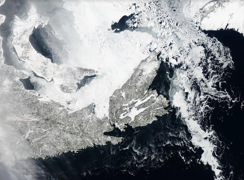
Photo Credit: NASA Aqua Satellite March 10, 2019
NASA’s Aqua satellite got a clear shot of Cape Breton and the Gulf Region on March 10th. Gulf ice is still locked in along the western shore, but breaks up into large ice pans coming around the northern tip – interesting texture in the ice.
The Bras d’Or still shows a thin open area east of Marble Mountain. The Gulf ice stops at the northern side of the Canso Causeway – with no ice showing on the south side.
Interested in Cape Breton weather information?
Check out the Cape Breton Mesonet WEBSITE


0
Log In or Sign Up to add a comment.- 1
arrow-eseek-eNo items to displayFacebook Comments